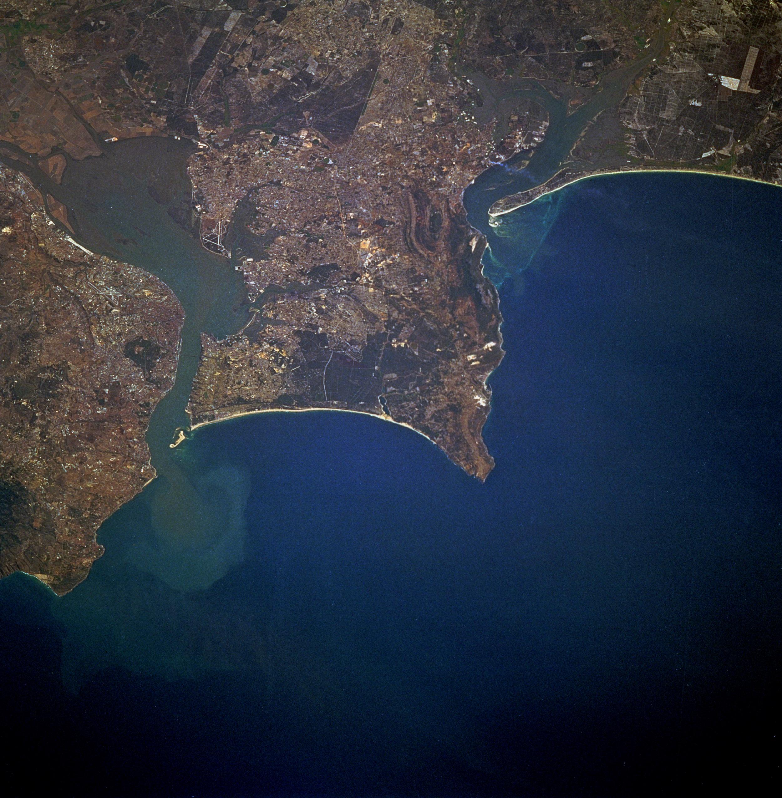

Lisbon and Tagus River Estuary, Portugal September 1992. Lisbon, the capital of Portugal, is observable north of the Tagus River estuary in this low-oblique, northeast-looking photograph. The estuary of the Tagus River, the longest river in the Iberian Peninsula, is 12 miles (19 kilometers) long and is considered one of the best harbors in Europe. Lisbon is set on seven terraced hills and has a population of almost 900 000. Industries include textiles, chemicals, steel, oil and sugar refining, shipbuilding, soap and flour production, and tourism. A massive earthquake almost destroyed the city in 1755. Loss of life exceeded 50 000 people, and many buildings, some over 1000 years old, were destroyed. The city was rebuilt, and no subsequent major earthquakes have occurred. Visible south of the Tagus River estuary are the cites (west to east) of Almada, Barreiro, and Montijo; farther south are Setúbal Bay and the Sado River estuary.
Fuente: NASA - National Aeronautics and Space Administration


