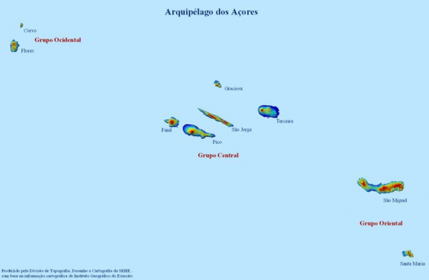

The Azores are divided into 19 municipalities (concelhos); each municipality is further divided into parishes (freguesias). The Azores have a total of 156 parishes. There are also 5 cities: Ponta Delgada and Ribeira Grande on SĂŁo Miguel Island; Angra do HeroĂsmo and Praia da VitĂłria on Terceira, and Horta on Faial. Santa Maria: Vila do Porto. SĂŁo Miguel: Lagoa, Nordeste, Ponta Delgada, Povoação, Ribeira Grande and Vila Franca do Campo. Terceira: Angra do HeroĂsmo and Vila da Praia da VitĂłria. Graciosa: Santa Cruz da Graciosa. SĂŁo Jorge: Calheta and Velas. Pico: Lajes do Pico, Madalena and SĂŁo Roque do Pico. Faial: Horta. Flores: Lajes das Flores and Santa Cruz das Flores. Corvo: Corvo.
Fuente: DGPRM/DSRM/DREM

